Home / Blog / Environment
Regional Hazards: earthquake, tsunami, volcano, fire and cyclone alerts for Singapore
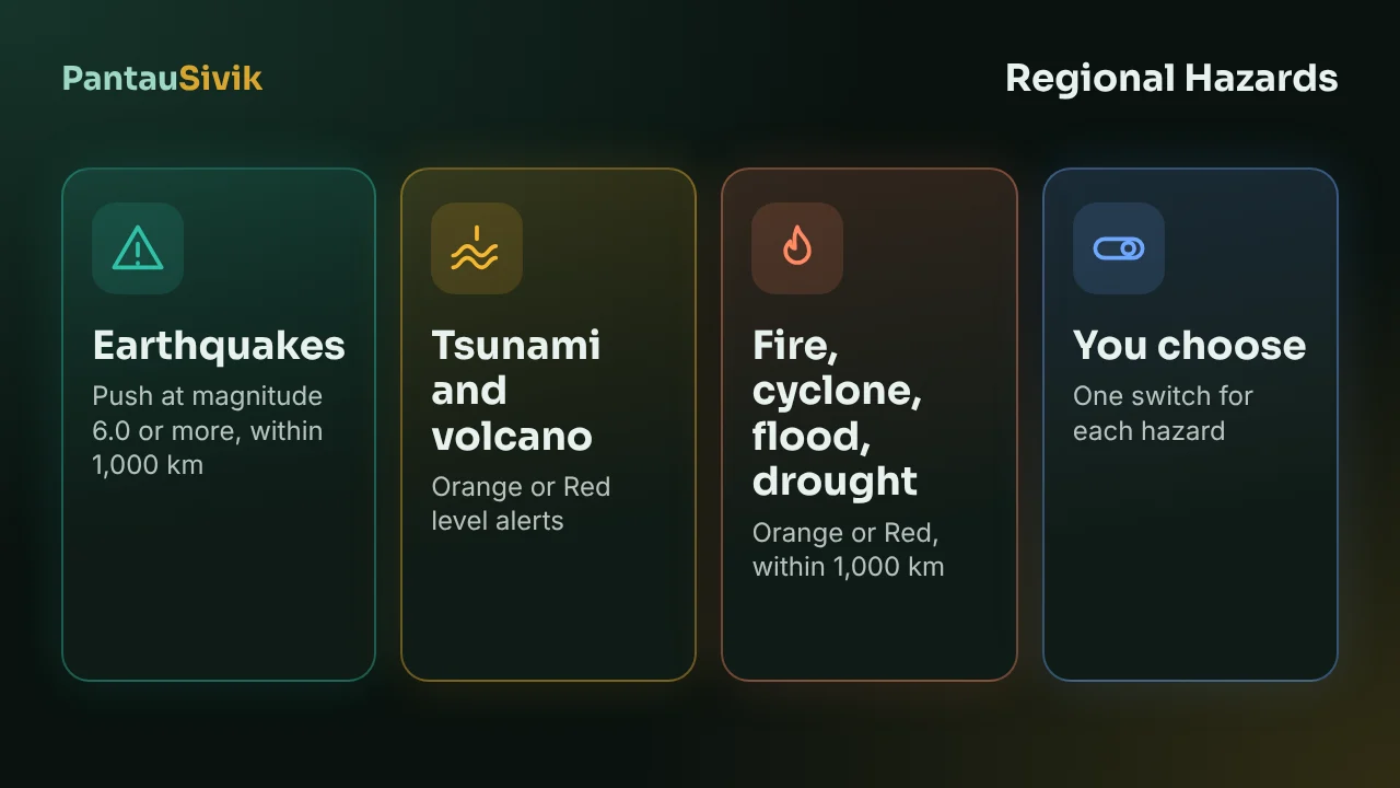
Singapore does not sit on a fault line, but big events nearby still reach it. Earthquakes in Sumatra are felt in tall buildings here, and smoke from forest fires in the region has pushed PSI up before. Build 49 adds a topic for this on the Alerts page: Regional Hazards.
What it watches
Seven hazards, each with its own push switch:
- Earthquake. A push when the magnitude is 6.0 or more and the quake is within 1,000 km of Singapore. Source: the US Geological Survey (USGS).
- Tsunami. From the tsunami flag in the USGS data, and from GDACS tsunami alerts.
- Volcano, forest fire, cyclone, regional flood and drought. From GDACS, the Global Disaster Alert and Coordination System. A push for an event rated Orange or Red within about 1,000 km.
GDACS rates events Green, Orange or Red. Green events are not pushed.
What you see in the app
Open Alerts, tap Regional Hazards, then pick a subtopic. Each event has a detail screen with View on map and Share, and a push opens that exact event. Most days the topic is empty. That means nothing is in range, not that something is broken.
Switching hazards on or off
Go to More, Settings, Notifications and find the Regional Hazards card. The hazards are on by default and set to Islandwide, so they are not tied to your home or work area. Turn off the ones you do not want, for example drought, which changes slowly.
What to keep in mind
- This is for Singapore. The Malaysia Alerts page shows earthquakes from USGS, and there are no Regional Hazards pushes for Malaysia yet.
- The data is public and can arrive after the source publishes it. It is not an official warning system. In an emergency, follow official channels.
- We have not seen a live Regional Hazards event yet, so we cannot tell you how often it will fire. A 6.0 quake within 1,000 km is not common.
GDACS data is used under a Creative Commons Attribution licence (CC BY 4.0). The credit is on the Sources page in the app. Step by step: the Regional Hazards guide.
Common questions
What are Regional Hazards in PantauSivik?
A topic on the Alerts page for big events outside Singapore: earthquake, tsunami, volcano, forest fire, cyclone, regional flood and drought.
How big must an earthquake be to send a push?
Magnitude 6.0 or more, within 1,000 km of Singapore.
Where does the data come from?
Earthquakes and tsunami flags come from USGS. Volcano, fire, cyclone, flood, drought and tsunami alerts come from GDACS.
Can I turn some hazards off?
Yes. Each hazard has its own switch under More, Settings, Notifications, Regional Hazards.
Does it work for Malaysia?
Not yet for pushes. The Malaysia Alerts page shows earthquakes from USGS.
Sources: PantauSivik app, version 1.84.2. Earthquake data from the US Geological Survey (USGS). Other hazards from GDACS (Global Disaster Alert and Coordination System), CC BY 4.0. Screens and wording can change between versions.
Information in PantauSivik comes from public sources and is there to help you plan. In an emergency, follow official channels. PantauSivik is independent and not affiliated with any government agency.
See also: Regional Hazards guide, Public Alerts guide, PantauSivik 1.84 release notes.