Home / Blog / App Updates
What is new in PantauSivik 1.84: alerts revamp, first and last train times, a full screen map and a new trip planner
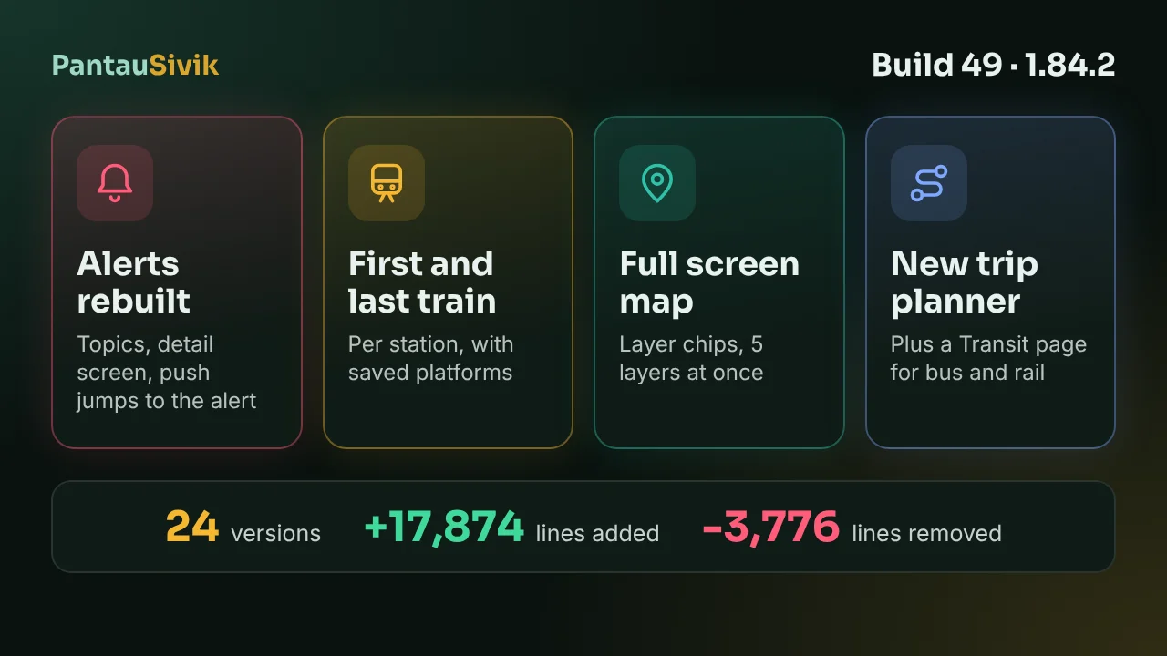
PantauSivik 1.84.2 (build 49) went live on Google Play early on Sunday 15 November 2026. It also carries every version from 1.69.0 to 1.84.1, 24 versions in all, because we tested them together and shipped them as one build. If you are still on 1.68 from 6 November, this is a big step. Four changes come first, then the smaller ones at the end.
In short: Alerts and notifications were rebuilt around topics, with a detail screen for every alert. You can now see first and last train times for any MRT or LRT station and save up to 4 platforms on Home. The Singapore map is full screen, with layer chips and 5 layers at a time. The trip planner and the Transit page have a new look, and Transit now has a Bus side and an MRT and LRT side.
1. Alerts and notifications, rebuilt
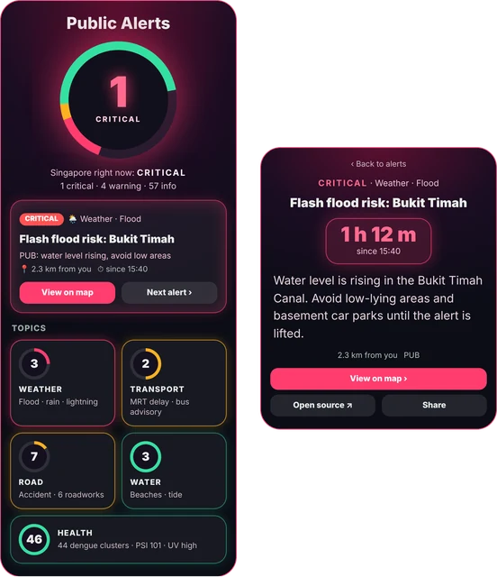
The Alerts page now sorts alerts by topic and group, and shows each one as a card you can open. A detail screen gives the full text, with Share and View on map buttons. If a push notification arrives, tapping it opens that exact alert, not just the list. The category list uses glow cards, and the alert list only appears once you pick a subtopic, so the first screen stays short.
The notification settings got the same treatment. There are 5 topic cards, and Bus, Heat and UV are now their own switches. Road incidents have 8 chips, so you can choose which kinds you hear about. Two new kinds of push alert arrived too: food recalls, and Regional Hazards for forest fire, cyclone, regional flood and drought, which come from the GDACS and USGS feeds. Earthquakes from USGS also show up on the Alerts page under Regional hazards. See the Public Alerts guide for every switch.
2. First and last train times
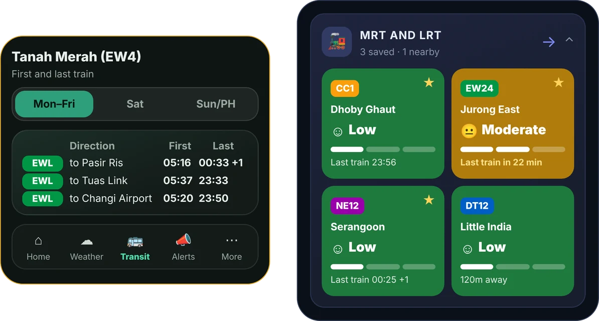
Tap the station name pill on an MRT or LRT station and you get the first and last train for each direction, with Weekday, Saturday and Sun/PH tabs. Close to the end of service, a "Last train in N min" line tells you how long you have left. The timetable is kept on the phone. We check it every week, and check public holidays every month, but if a time matters, confirm it with the operator before a late night out.
You can also save platforms. Tap the star on a platform, up to 4, and they show first on the Home MRT and LRT card with their last train time. A Saved platforms card, an Add a platform dialog and a Manage sheet let you change the list. Station search now shows line badges, so you can tell Bukit Panjang on the Downtown Line from the LRT. The platform crowds guide covers the rest of the card.
3. The Singapore map, full screen
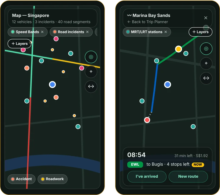
The map now fills the screen. Layers sit in chips along the top and in a Layers panel, and a floating Done button closes it. You can have up to 5 layers on at once, to keep the map readable. New layers include BCRS return points, Speed cameras and Public toilets, and EV, BCRS and toilet markers hide when you zoom out so they do not cover the map. Layers now take the colour of their group: the Health group for dengue, and Traffic is now a deep teal. See map layers, incidents and your active trip for how they work together.
4. Trip planner and the Transit page
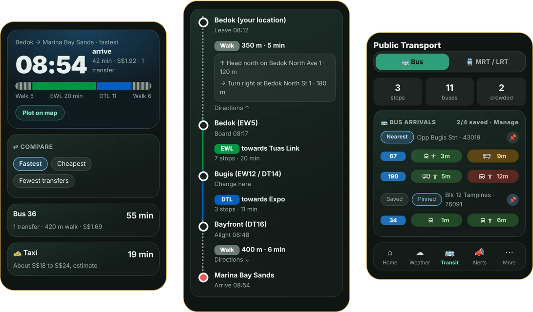
The Singapore trip planner has a new look, from the search screen to the results. Result cards show the arrival time, a leg bar of the whole journey and a step by step timeline. The Map tab opens as a sheet, and a History pill on Recent trips opens your trip history page. A Plot on map pill on the arrival row draws the trip on the map.
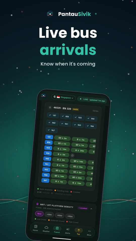
The Transit page is split in two. A switch moves you between a Bus side and an MRT and LRT side. You can add a new stop from the Bus side, and rail rows now show station names. The Home Bus and MRT/LRT cards open the matching side. If you use the Walker setup, the Trip Planner is now in your bottom bar. The bus arrival times guide shows the Bus side in detail.
Also in this release
- A BCRS return points card on Home, for the can and bottle deposit scheme.
- Fixes to the Bus card and the Community card.
- The Grab button is gone from the Malaysia trip planner.
- The arrival label now wraps properly at large font sizes.
- The Android build tools were updated. You will not see a difference, but it keeps the app current for newer phones.
Under the hood
For the numbers: we compared the code of build 48 (1.68.0, 5 November) with build 49 (1.84.2, 14 November) in our own repository. The release has 86 commits and touches 321 files, with 17,874 lines added and 3,776 removed. That is a count of changed lines, so a reworded line counts as one removed and one added. It says how much was touched, not how big the app is.
| Part | Added | Removed |
|---|---|---|
| App code (Dart) | 6,923 | 3,501 |
| Translations, 7 languages | 5,461 | 89 |
| App tests | 2,860 | 77 |
| Data files (public toilets, speed cameras) | 1,446 | 0 |
| Backend | 845 | 94 |
| Scripts and other | about 340 | about 15 |
The translations include files that Flutter generates, so the hand written share is smaller: about 10,950 lines added and 3,670 removed once translations and data files are left out. The biggest rewrites were the Alerts page, the map widget and the two Home cards.
How to update
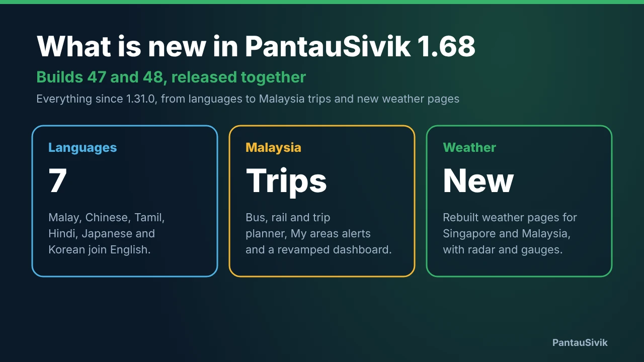
Open Google Play, search for PantauSivik and tap Update. The release is Android only and free. If the update is not showing yet, Google Play rolls out in waves, so give it a few hours and check again. Earlier changes are in What is new in 1.68 and in the History launch post. The app is now also on Google Play in 21 countries and regions, which we cover in a separate post for visitors.
What this does not tell you
- Train times in the app come from a table we keep and check ourselves, not a live feed. Use the operator's notices for last minute changes.
- The Alerts feeds come from public sources and can arrive late or not at all. In an emergency, follow official channels.
- Not every feature is on every screen size or setup, such as the Walker bottom bar.
Common questions
What is the latest version of PantauSivik?
Version 1.84.2, build 49, went live on Google Play on 15 November 2026. It includes every change from 1.69.0 onward, 24 versions in all.
Does PantauSivik show first and last train times?
Yes. Tap the station name pill on an MRT or LRT station for the first and last train in each direction, with Weekday, Saturday and Sun/PH tabs. The timetable is kept on the phone and checked by ZN Labs every week, and public holidays every month.
How many map layers can I turn on at once?
Up to 5. The Singapore map is now full screen, with layer chips and a Layers panel, and a floating Done button to close it.
Can I save my usual MRT or LRT platform?
Yes. Tap the star on a platform to save it, up to 4. Saved platforms show first on the Home MRT and LRT card, with the last train time.
What are Regional Hazards alerts?
They are push alerts for forest fire, cyclone, regional flood and drought, drawn from the GDACS and USGS feeds, plus earthquakes from USGS on the Alerts page.
Is the update available on iPhone?
No. PantauSivik is Android only for now.
Sources: PantauSivik release notes for versions 1.69.0 to 1.84.2 (build 49), 15 November 2026. Hazard alerts use data from GDACS and the US Geological Survey (USGS). The app is independent of both.
Information in PantauSivik comes from public sources and is there to help you plan. In an emergency, follow official channels. PantauSivik is independent and not affiliated with any government agency.
See also: What is new in 1.68, Public Alerts guide, Trip planner guide, Map layers guide.